Acocks Green History Society
Billesley, Hall Green and Acocks Green
Billesley
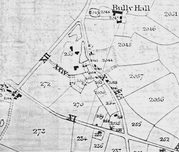
2057 Brick Kiln Field (owner James Taylor, occupier Daniel Whitehouse)
Location: north side of Brook Lane in Moseley golf course. Old claypits are shown on the 1884 map.
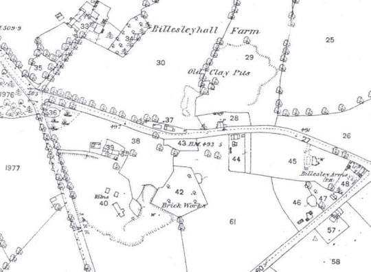
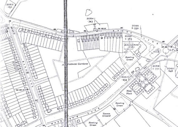
260 Cottage, Garden and Brickyard (owner James Taylor, tenant Aaron Peyton)
Location: south side of Brook Lane in a triangle of land at corner of Barn Lane. A brickworks is shown in this area in 1884, but with different buildings. Joseph Payton was listed as a brick maker at Billesley Common from 1872 until 1890 (an earlier listing in 1852 is without location, and Frederick Payton is at Acocks Green in 1858). The 1881 Census has Joseph Payton as a brick manufacturer, living at Billesley Farm. Remains of the older buildings may be in gardens at the corner of Barn and Brook Lanes. Allotments replaced the brickworks site.
Hall Green
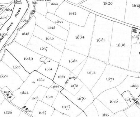
1673 Brickhouse and Garden (owner John Dolphin, occupier Elizabeth Magenis)
Estimated location: north side of Doveridge Road, Hall Green, in back gardens.
1660 Brick House Meadow (owner Christopher Scriber, tenant himself)
Estimate location of structure: under Tixall Road between Doveridge and Eggington Roads, Hall Green, the boundary with field 1654 is not defined.
Acocks Green
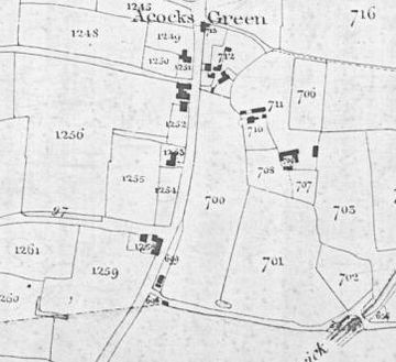
700 Brickkiln Meadow (owner John Mumford, occupier himself)
Location: a large field on the north side of the Warwick Road between Dolphin Lane and the city boundary: no buildings are shown on the Tithe Map.
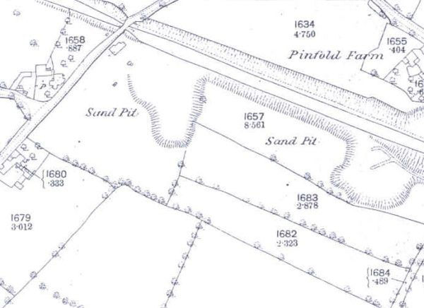
Directory listings show references to brick making in Acocks Green from the 1850s. J. Purrott is listed in Yardley in 1856, and Frederick Payton at Acocks Green in 1858. Purrott is at Acocks Green in 1860 and 1864. Clarke and Clifford are listed at Yardley tunnel, on the canal, between 1867 and 1871, and in 1872 William Mansfield is at Bordesley Green and Acocks Green (Mansfields owned Pinfold Farm nearby, but the brick maker may or may not be related). Stephenson refers to a Henry Smith at Rushall Lane in the 1870s (this was later Stockfield Road). In 1875 David Shirley is listed, and in 1878 Charles Shirley and Mrs Caroline Smith are listed at Stockfield Road.
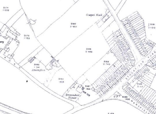
Caroline Smith is listed here until 1884, with the location described as South Yardley in 1881. The 1881 Census has Caroline, a widow, as head of the family, with occupation as brick manufacturer. With her at Broom Hill Cottage are four sons, Alfred, Jessie, Thomas, and William, all brick makers. By 1883 the directory shows Broom Hill Cottage occupied by a Joseph Gilman. The 1916 map shows Broom Hill House on the corner of Stockfield and Amington Roads. Even if this is not the cottage itself, it must be very close by.
It is reasonable to conclude that the works was on the south side of the canal between Stockfield Road and Yardley Road, or nearby, and indeed there are pits shown here on Ordnance Survey maps. The maps show that sand and gravel were extracted here, confirming the location of part of the dry ridgeway route to Yardley church, rather than disproving the extraction of clay nearby. Spoil banks are named on the Tithe Schedule along the canal here, piled up as the canal was dug through the ridge: perhaps that is where some clay was obtained. In 1888 a Jesse Smith is listed at Tyseley, and in 1890 Caroline joins him there. It seems possible, therefore, that brick making had ceased by the mid-1880s in Acocks Green. The pits were later used by Harding's bakery at the Swan for dumping their waste: this resulted in a plague of crickets for occupants of new houses on Kilmorie Road.