 Acocks Green History Society
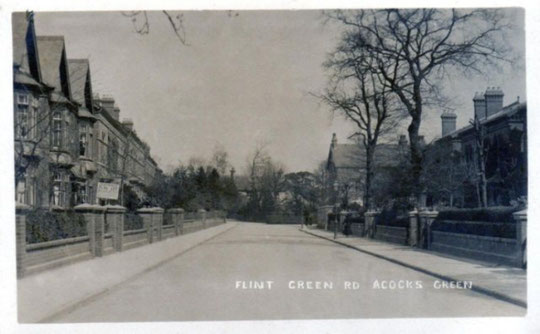
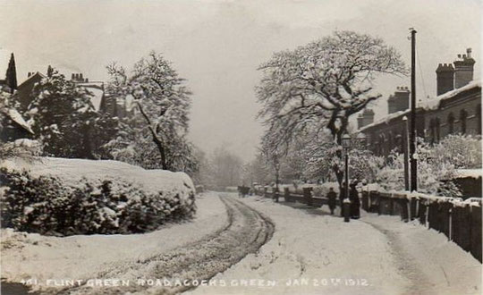
Flint Green Road
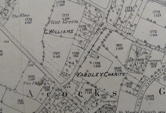
Flint Green was one of the three hamlets that came to make up Acocks Green. The name Flint Green Road has also been applied to Arden Road at times, as well as Flint Green Lane. Flint Green originally appears to have been at the junction of Arden Road and Sherbourne Road: as a document in the library of Birmingham is entitled:
"Yardley Charity Estates. Leases of three adjoining pieces of land fronting the road leading from Flints Green to the Warwick Road at Acocks Green [?Flint Green Road] | Each lease contains a plan, 1885". This refers to the development of the eastern side of the road.
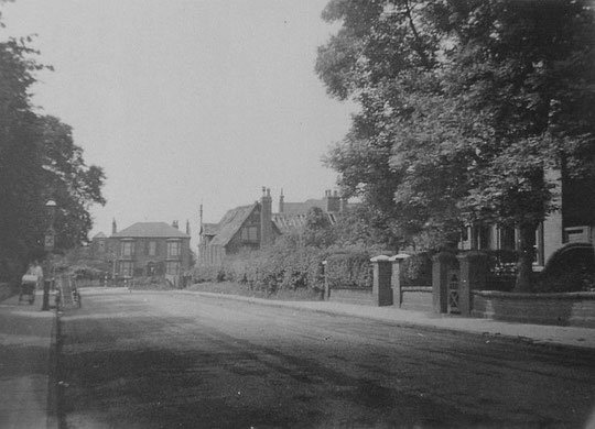
The Tithe map extract below shows buildings at the Warwick Road end. These were owned by Henry Greswolde in 1841. The northern set were demolished in the 1950s for council housing. The buildings at the corner of Arden Road was replaced by number 44 (Bedale/Avondene) around 1880. They were a stable and gig house for Sarah Crane, a woman of independent means, in 1841. On what is now Rookwood Road is Flint Green House, much extended since and listed with Sherbourne Road now. The original green may have been here, where the track and footpath onto Stock Field led, and it and the back lane (Arden Road), Malt House Lane (Sherbourne Road) and the unnamed track (Flint Green Road) met.
44 and 42 (Sherbourne House) were listed in the 1880 directory. In the 1881 census Allan Whitfield, a safe manufacturer, was at Sherbourne House, while Bedale House was occupied by Alexander Walker, a banker.
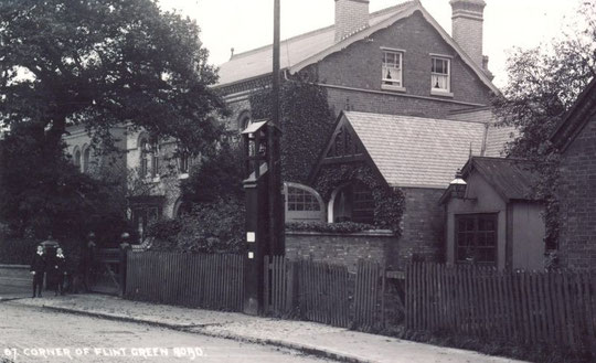
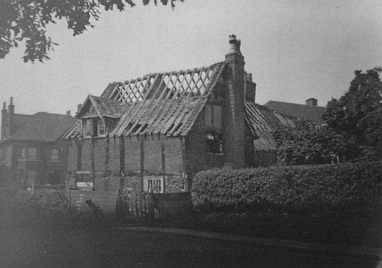
On the east side of the road, semis numbers 3 and 5, look inter-war, but are not on the 1938 Six-Inch map. There is a curious low detached building between 5 and 9, which appears to be part of number 9's land and appears on the 1904 O.S. map. Also on that map, just below there, is a tiny building, which is the early fire station shown on the postcard below. It is not on the 1916 map. Number 9 (Fair Haven) is listed in 1888 (and therefore number 11, Plasgwyn is standing). Ivydene/Ivy Dean (number 13) is listed in 1888, and therefore Hollyhurst, number 15, is also there. Both number 17 (Fairfield) and number 19 (Eversleigh), which was used as a school) are listed in the 1888 directory. Number 21 (Afenlee) is also of that date, but the Second World War bombing maps show a direct hit there, and the house on that spot is modern , showing on the 1954 O.S. map and altered since, and not in keeping with the rest of the houses in terms of architectural appearance. Number 23 (Kingstone) was also listed in 1888, but both number 25 (Holmeshurst) and number 27 (Rosslyn) were in the 1886 directory and appear on the 1886 map below. Number 29 (Swinbrook) and number 31 (Brookfield) were listed in 1890. New development is taking place here, named Bricksmith Close/Mews/Flint Green Mews.
On the other side of the road, there are council properties c. 1954 at the Warwick Road end (8-14), which replaced a half-timbered cottage. These are followed by numbers 16-28, all named and listed in 1903: number 16, detached (Cherry Tree Cottage), semis number 18 (Vernon Cottage) and 20 (Hawarden Cottage), semis 22 (Dorothy Cottage) and 24 (Glynn Cottage), semis 26 (Sulby Cottage) and 28 (Abbey Cottage).
Numbers 30 (Glenelg) and 32 (Rougemount) are listed in 1886, as are 34 (Eaves Vale) and 36 (Oakthorpe). Number 38 (Lindenhurst) is listed in 1886 as well, so number 40 (Ardendale) must be of that date also. They are all on the 1886 map, which suggests they may be a little earlier.
We have mentioned numbers 42 and 44 above. Acocks Green Focus Group have campaigned against inappropriate development of these two houses. Go to the website and enter '44 Flint Green Road' in the search box. There are photos on Flickr as well if you follow the DynaMick link from their homepage.
The Imperial War Museum has a beautiful series of photographs of Flint Green Road Nursery for Working Mothers, take in 1942. We have treated this building under Sherbourne Road. They can be found at the IWM website by searching under "Flint Green". A researcher from Derby University is looking into the history of the nursery. If anyone has any memories or photographs of the nursery, please contact us at aghistsoc@hotmail.com.


It is now possible to see the sequence of large-scale O.S. maps online at www.old-maps.co.uk. For this road enter the postcode B27 6QA, and choose the 1:2,500 maps up until 1952-4 (there is no 1937 map at this scale). Use the plus and minus buttons to change how close up you wish to see the houses. The map can be dragged by using click and hold as normal.