 Acocks Green History Society
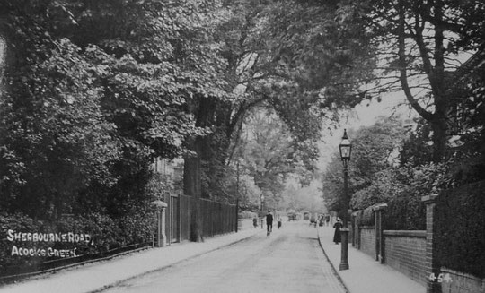
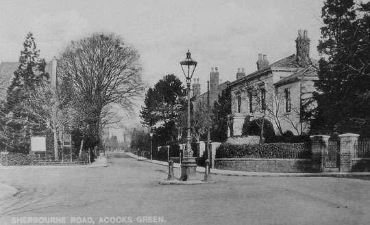
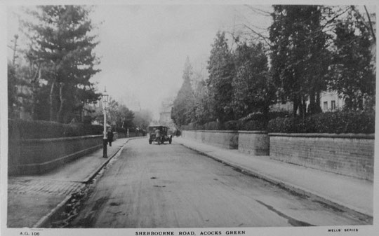
Sherbourne Road
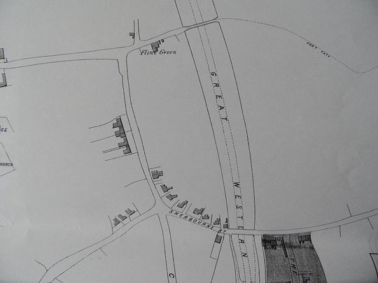
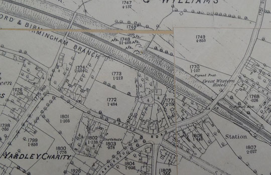
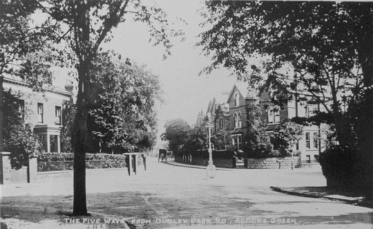
Sherbourne was at one time one of the most exclusive roads in Acocks Green, home, among others, to three of the leading gun makers of Birmingham. Working out its history is complicated by the fact that parts of it have been seen as belonging to Flint Green Lane/Road and Arden Road, and worse still to Yardley Lane/Road or Station Road. It was even called Oxford Road on the 1886 map. Many fine houses have been lost, and the Public Hall too, which used to stand on the corner of Sherbourne and Dudley Park Roads until the mid-1960s.
Number 4, Flint Green House, is shown on the 1840s Tithe map below. It was later extended and lived in by, among others Edgar Brookes (1851) and Charles Playfair (1861 most likely this house), both gun makers, Alfred Lovekin, a silversmith (1881 census and 1876 directory), and Gideon Ryall, a master tailor (1891 census). In 1942 it became a children's nursery, and its history until 1980 is presented on the Connecting Histories website. Enter 'Flint Green House' in the search box. Currently it is a mental health facility. The Imperial War Museum has an excellent series of photographs of this building, named as Flint Green Road Nursery for Working Mothers, take in 1942. They can be found at the IWM website by searching under "Flint Green". A researcher from Derby University is looking into the history of the nursery. If anyone has any memories or photographs of the nursery, please contact us at aghistsoc@hotmail.com.
Numbers 6 (Cartref/Green Bank) are listed in 1886, as are 10 (Oakfield) and 12 (Southfield). 10 and 12 were demolished for the entrance to Avery Drive, and a new number 10 stands there. Avery Drive was partly occupied early in 1975. Numbers 14 (Belmount) and 16 (Melrose) are listed in 1896, number 20 (Dovedale) and therefore number 18 was standing) in 1896, 22 (Auckland House) in 1892 and therefore 24 (Oakthorpe) had been built), 28 (The Shrubbery) in 1892 and therefore 26 (Park View). Matching names to numbers may have an error here, around number 18. Numbers 18 and 20 are a care home now, called Sherbourne Grange.
This group of four pairs of large semis is all that is left of the older houses at the eastern end of this side of the road. Number 30 (Fernside) and number 32 (Rosedale) appear on the Cook estate map of 1875 below, and possible directory entries for them can be found from 1873. Next to these was an empty plot, or rather a path to a copse/orchard. Number 36, Carlton House was a doctor's surgery for many years, and was probably built c. 1857 (see below). Number 38 (Ashfield) and number 40 (Oak Mount/Villa) may also be of that date. Numbers 30-40 were swept away for Sherbourne Court in the mid-1960s, the flats at 34, 36 and 38 (Sherbourne Court) being listed from 1967.
Sherbourne Avenue has Allandale, for many years a school, Milton House, and Ingleside, and two very recent detached houses. One of these is listed on the 1861 census, but there are two unoccupied plots.
Number 44 still stands, and was called Westbourne House. It was listed in 1858. Number 46 Bourne Villa (or ? Brookleigh) is listed in 1858. Number 48, Clifton Villa, was also listed in 1858. Finally number 50, the Cottage, or Acocks Green Cottage, was also listed then. These houses at least are still standing, and recall the Victorian heyday of the road, whatever function they now perform.
On the other side of the road, numbers 1 and 3 appeared between 1904 and 1916. They were occupied by E.H. Smith, builders' merchants, and have been demolished and replaced. (The family lived at 44 Flint Green Road). Number 5 (?Aberview) and 7 (Wittenberg) were listed in 1896. They have recently been demolished and replaced by houses with similar frontages. The Acocks Green Focus Group have been active here, but were not able to prevent replacement.
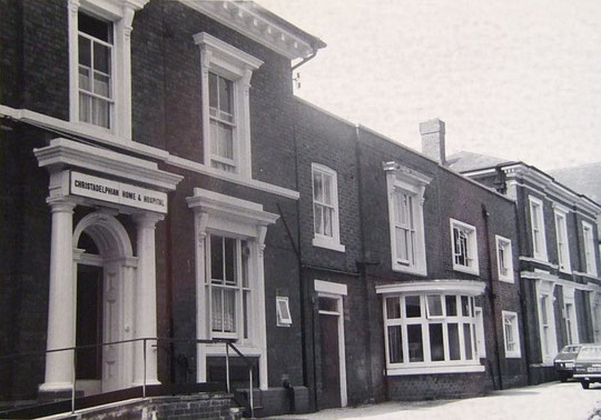
Number 9 (Grantham House) is listed in 1892, as is number 11 (Eversley). Number 13 (Cambridge House/Brockenhurst) and number 15 (Apsley House/Woodstock) are listed in the 1891 census. Number 17 (Oakwood) was probably built c. 1857, as were number 19 (Bon-Accord) and number 21 (?) (Richmond House). These were the gun makers' houses: John Field Swinburn, Charles Playfair, and Thomas Bentley, respectively. Charles Playfair was actually listed in Acocks Green in the 1861 census on Malt House Lane (see below). A child, Thomas Bentley, was living with the Playfairs in 1861. The two men ran Bentley and Playfair. These houses eventually became the Christadelphian Nursing Home, and have been demolished and replaced by a newer sheltered housing scheme, Olivet. A 1980s photo can be seen below.
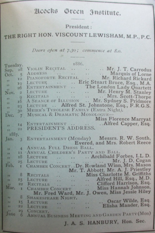
Numbers 23-29 are inter-war detached, appearing in directories in 1939. On the corner stood the Public Hall until the mid-1960s. This was built in 1879 as the Institute: a place for study, lectures and events: a high class facility befitting the new inhabitants of the area. By then the Harris malthouse had gone. Oscar Wilde gave a lecture there (see programme below, courtesy of David Treadwell). The Institute served as a courthouse as well until 1909. It was sold to the Roman Catholic Diocese in January 1937, and the church of Sacred Heart and Holy Souls used it as a Parish Hall. The remaining grounds were sold for housing on Sherbourne and Dudley Park Roads around the same time. Some local people remember going to dances at the Parish Hall. In the mid-1950s it was used as an annexe to Holy Souls school, while Archibishop Ilsley's site was being developed. Thanks to Sally Saunders for this information. The Diocese put it up for sale in 1957. The flat block called Kettering House which now occupies the site was built in 1981, although it appears the land had been vacant for more than ten years.
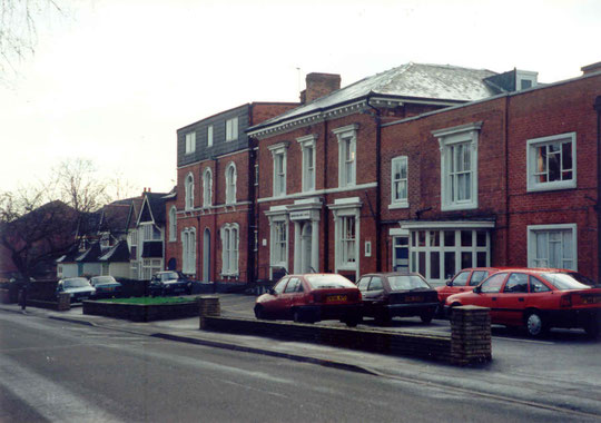
Number 35, next to Oxford Road, is on the 1888 O.S. map and was called Edendale in the 1891 census, and number 37 (Ellesmere), and 39 (Silverdale/Frodsham) were also on the 1888 map. Number 41 (Windermere) was listed in 1880, as was number 43 (Fernlea). Number 45 (Holly Bank/Glendwr) was on the 1888 map, as was number 47 (later Twyford). Number 49, Bridge House, was occupied by George Mayell, a jeweller, in 1891, and he is listed in Acocks Green from 1876. This house is shown on the Cook estate map of 1875. It may be Cook's house of the 1851 census (see below). It is now part of the Quality Hotel.
At the time of the Tithe Map the owner of most of the fields that came to make up the first phase of Sherbourne Road was a Peter Harris (fields 771,772, and 775, with his house at 773). He is described as a maltster in the 1841 census, but the house is not listed as such at that time. However, in the 1851 census, his widow, Mary, is listed with a house and malthouse in an entry followed by one for Acocks Green Field, where brassfounder Benjamin Cook Jnr's former house stands. This may not be the same house at Flint Green in the 1841 census where Cook is listed. Nearby there are a few labourers' cottages and the Thickbroom farmhouse (corner of Wynford Road, showing how undeveloped Yardley Lane/Road was in 1851 before the railway came, at least as far as the canal tunnel, where there were more dwellings). The Harris buildings are not on the 1875 Cook estate map: the Institute/Public Hall was built on that site. It would seem logical that all Mrs Harris's fields would have been developed around the same time. Part of Sherbourne Road on the 1861 census covers the families that occupied 50 (Onions), 48 (Balleny), 46 (Onions again), 44 (Baxter), the Sherbourne Avenue plots, and two houses occupied by a banker and a commercial traveller (40 and 38?). Immediately after that we have an entry for Old Malt House Lane for a brickmaker, but then a merchant's factor, and insurance agent, and another merchant's factor. It would make sense if these were houses numbers 36, 21, 19 and 17. Also in the census Malt House Lane appears next to entries for Flint Green, with a Professor of History, Richard Allcott, and Charles Playfair, gun manufacturer. Edgar Brookes, gun maker, is at Flint Green House in 1851, so it is possible that Charles Playfair was also at Flint Green House. Where Professor Allcott was is not easy to establish, though.
In any event, it would seem reasonable to suggest c. 1857 as a building date for the first phase of Sherbourne Road, as none of the names belonging to this road appear in an 1855 directory, but some do appear in an 1858 directory.
Somewhat confusingly, in the 1861 census Sherbourne Road is seen as continuing on past the Great Western, including Cottesbrook House and Fern Bank (Eastbourne House) .
The large pairs of semis built in the 1890s were on land then belonging to Yardley Great Trust (field 770). Presumably that is why they were not developed until later.


It is now possible to see the sequence of large-scale O.S. maps online at www.old-maps.co.uk. For this road enter the postcode B27 6DX, and choose the 1:2,500 maps up until 1952-4 (there is no 1937 map at this scale). Use the plus and minus buttons to change how close up you wish to see the houses. The map can be dragged by using click and hold as normal.